And that’s when I stumbled on something called BatchGeo. It’s a simple tool to map data. It is crazy easy to use.
You start with a spreadsheet. If you have Excel, great. If not, something in Google Drive works just fine.
Then you copy that data and pop it into the BatchGeo engine. It gives you the parameters to help you map the data, and then…. it spits out a custom map for you. And an embed code, too!
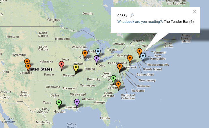
BatchGeo helped me make this map for BooksAround in just a few minutes:
It’s a really good option if you’re trying to make a simple map to show off geographic data in a story. Check BatchGeo out here.
And another mapping app just got a lot of buzz at SXSW. It’s called Plotter, and they’re trying to make maps more social. If you’ve got an iPhone, check it out here.
One more thing, unrelated to maps: On the heels of last week’s email about verifying photos, I wanted to pass along this excellent link roundup of blog posts about verifying content on social media. It’s really useful.
Now get out there and tell some great stories today!